Location: Pinnacles National Park, California
Hike: Loop trail through Bear Gulch and High Peaks (Moses Spring Trail to Bear Gulch Cave Trail to Rim Trail to High Peaks trail to Condor Gulch Trail then back to the Bear Gulch parking lot)
Distance: 6.1 miles (6.5 miles if you add exploring trail off shoots)
Duration: 5 hours
Elevation: 1300 ft
Difficulty level: Moderate to strenuous
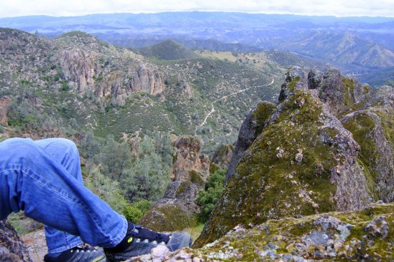
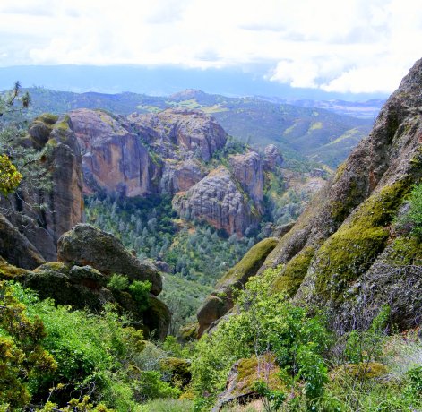
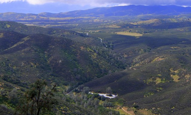
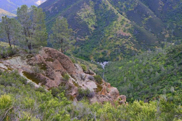
Pinnacles National Park is a place of exceptional beauty everywhere you turn. My daughter and I shared one camera, and between the two of us took over 400 pictures just on Saturday alone. I kept hearing her say, “this will be my new screen shot,” over and over again. I, myself, kept tripping over rocks because I didn’t want to look down at the trail – too much spectacular scenery to take in!
Everyone talks about the caves at Pinnacles, so we started our hike heading to the caves. We weren’t sure about the weather (showers forecasted throughout the day), so we wanted to see as much as we could up front in case the weather got too bad to hike.
Summary of our hike:
Bear Gulch parking area to Moses Springs trail head – 0.3 miles
Moses Springs Trail to Bear Gulch Reservoir (through the caves) – 0.7 miles
Rim Trail – 0.4 miles
High Peaks Trail to the Juniper Canyon trail junction – 1.5 miles
High Peaks Trail to Tunnel Trail junction through the Steep and Narrow section – 0.7 mile
High Peaks Trail to Condor Gulch Trail – 0.6 miles
Condor Gulch Trail to Bear Gulch parking area – 1.7 miles
We also explored the Chalone Trail and several off shoots off 0f High Peaks Trail (+ 0.4 miles)
Total miles hiked = 6.5 miles
Moses Springs Trail
We didn’t encounter many people along this section and we took our time getting introduced to the colorful rock formations of Pinnacles.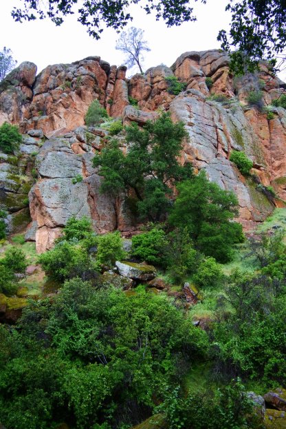
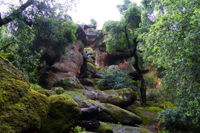 The trail continues to gradually climb uphill until you reach this area. I initially thought this was the cave entrance, but it turned out to be a tunnel.
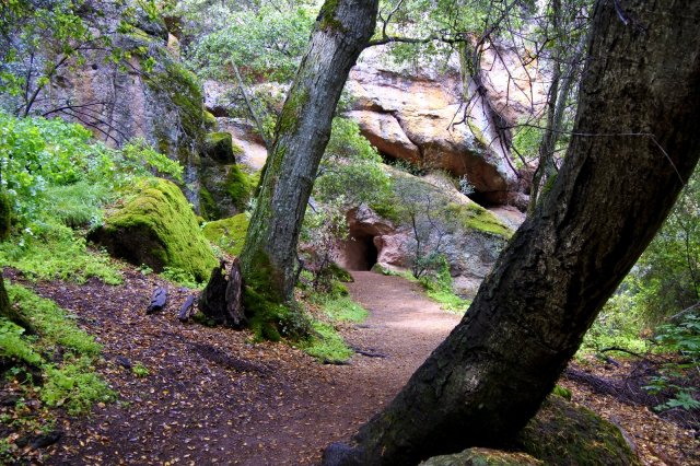
 The cave entrance is actually through this area.
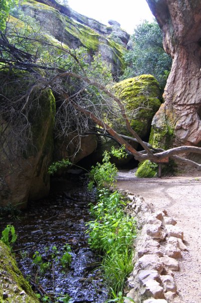
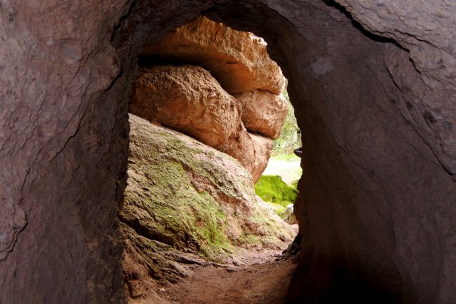
 The cave really lived up to all the hype! The waterfalls and streams running through the cave made water an interesting focal point. The sound of the waterfall was very loud in some sections and you could definitely feel the moisture in the air.
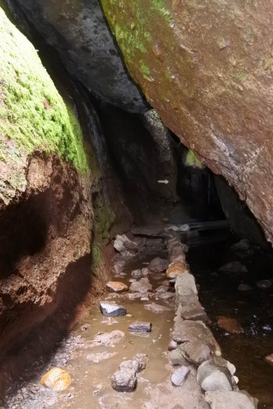
There were areas where light from above illuminated the glistening walls and sparkling streams you were walking next to, while other areas it was so dark that you needed a flashlight to see right in front of you. This is because these caves are talus caves, meaning they were formed by huge boulders that dropped into the narrow canyons forming a roof.

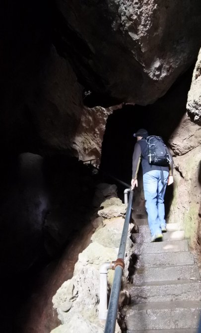
Make sure to bring a flashlight, not just for safety, but to be able see it all, especially the waterfalls in the dark (you can hear them). There is a definite “trail” that you follow with pathways, stairs that have handrails, and metal walkways. The cave was so fun to explore! That’s why we came back and walked through it again the next day.
After we squeezed out of the cave, there was just a small hike up to the reservoir.
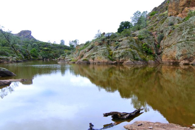
We wanted to find a place to sit and have a snack. Everyone else seemed to have the same idea, this area was a popular spot for having a mid morning snack. We walked east on Chalone trail for a bit, then followed a trail next to the reservoir.Pretty soon, we found a spot with a flat rock to sit on.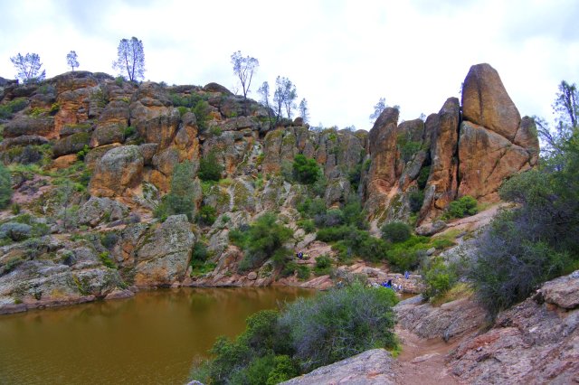 The weather seemed to be holding, so we decided to go for a longer hike. We headed back to the Rim Trail sign which was near the stairs that lead up to the reservoir, and started our ascent towards High Peaks.

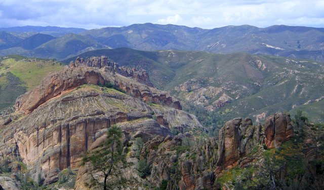
High Peaks Trail to the Juniper Canyon Trail junction
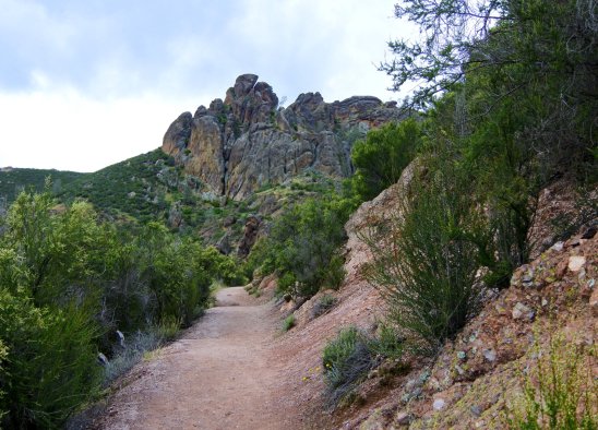
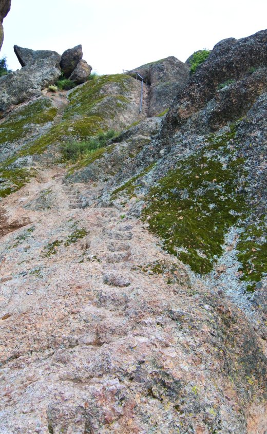
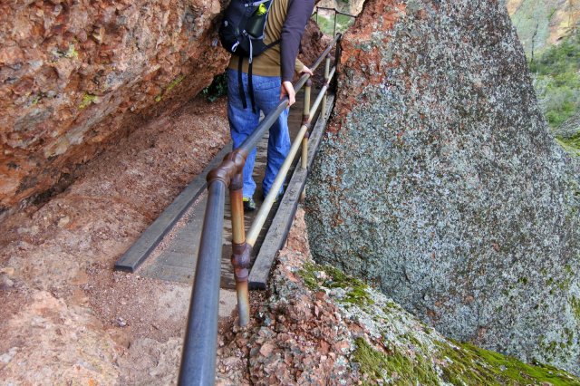
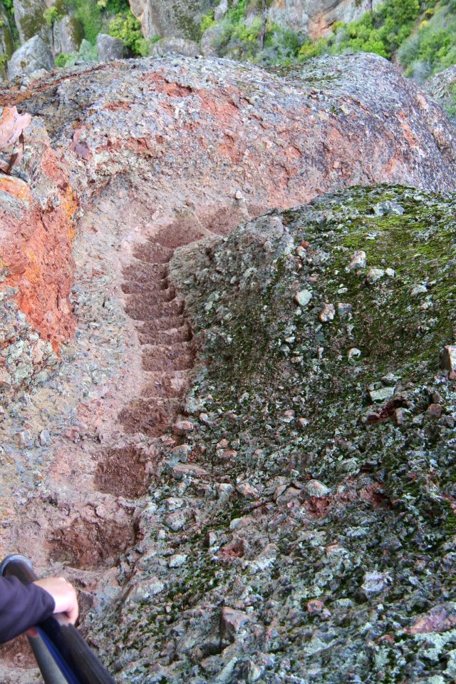
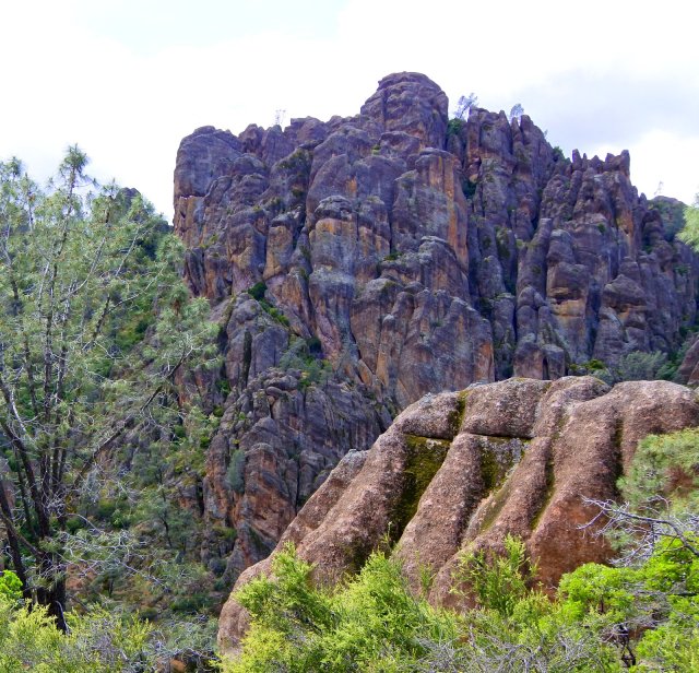
High Peaks Trail (through the Steep and Narrow section)
Here comes the Steep and Narrow section.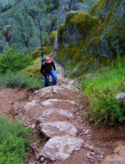
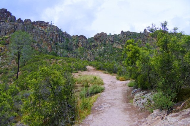
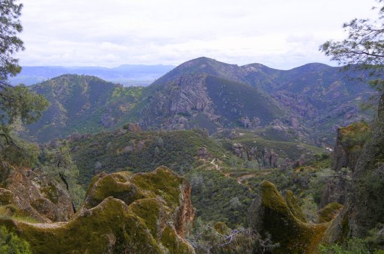
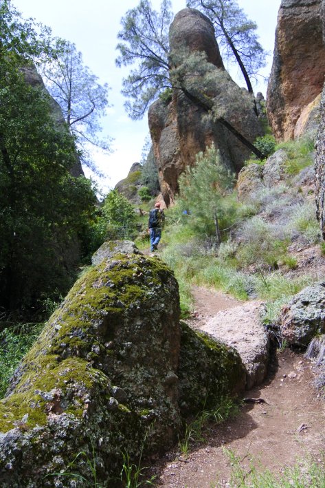
High Peaks Trail to Condor Gulch Trail
Condor Gulch Trail to Bear Gulch parking area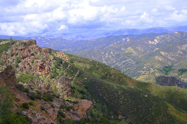

The last bit of the hike to the parking lot. There were many wildflowers in this section (see previous post for wildflower pictures).

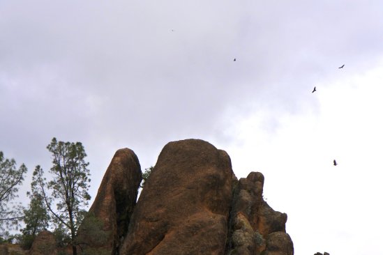
This hike took us about 5 hours, stopping twice to eat and rest, and pausing to take so many pictures! We spent about 30 minutes exploring various trail off shoots and climbing on rocks near the caves which was so fun. You can definitely do this hike faster, but this hike is not one to power through. The caves and the Steep and Narrow sections are worth taking your time and fully exploring. Marvel at the wildflowers all around, and try to spot one of the California condors that soar high above. There is just so much to see and appreciate. After the hike don’t forget to reward yourself with an ice cream bar from the store next to the visitor’s center (open until 5 pm), it was the perfect way to forget about our sore muscles… for a little while at least.
If you’re interested, check out our experience at the campground and explorations (Springtime in Pinnacles National Park)

This place is truly amazing. What unique places and the pics were awesome. The scenery, caves and trail, seemed like a movie set because they were so spectacular. Wow , One not to be missed. I want new knees for giving it a try. What adventures!!
On Mon, Apr 18, 2016 at 9:27 PM, Weekend Campervanning wrote:
> weekendcampervanning posted: “Location: Pinnacles National Park, > California Hike: Loop trail through Bear Gulch and High Peaks (Moses Spring > Trail to Bear Gulch Cave Trail to Rim Trail to High Peaks trail to Condor > Gulch Trail then back to the Bear Gulch parking lot) Distance: 6.1 mil” >
LikeLike
Thanks for your sweet comment! I never knew Pinnacles had such a treasure of a hike. I don’t know how many times we passed that sign on Hwy 101. I guess it goes to show that it does pay to explore!
LikeLike
Great pictures and thank you for sharing. I am going to add this to our list and next time we are in that area we are going to have to spend a few days visiting.
LikeLike
Thanks, and thank YOU for visiting the site. Have a great time visiting Pinnacles!
LikeLike
I hope you don’t mind, but I just pinned this post! I only have a day at Pinnacles and was trying to figure out the best way to see the maximum amount possible, so this is perfect! And thanks so much for listing the names of the trails, too–totally going to follow your itinerary. I actually stopped by to check out your bike posts…we’ll be on San Francisco Bay our last night, and the hotel we’re staying at loans out bicycles, so I was excited to revisit your bike posts. I think the SF Bay Trail is right outside the hotel, so I was psyched to read your post on that. So much great info on Pinnacles campsites, too–wish I’d stopped here first before reserving; your site looked great (I got #61; it’s near the creek, I think? Loop C). I’m also stalking your awesome Joshua Tree posts, too…sorry for being creepy, lol! Thank you sooo much for putting all of this together–so helpful!!
LikeLiked by 1 person
It means a lot that you find the posts helpful, thank you for reading them! Glad you are going to Pinnacles, that hike has remained one of our all time favorites. Hope you can get some good condor pics, we weren’t too successful. Sounds like you are doing some great trip planning for your ET (epic trip)! Carry on, carry on… 🙂
LikeLiked by 1 person
This is so helpful! We’ll be visiting Pinnacles soon and I think we’ll follow the trail that you did. Thank you!
LikeLiked by 1 person
Looking forward to reading all about your adventures at Pinnacles!
LikeLike