Location: Big Basin State Park, California
Hike distance: 11 miles
Elevation gain: ~2000 ft
Hike Length: 5-6 hours
Hike level: difficult/strenuous
The Berry Creek Falls loop hike was our main reason for visiting Big Basin state park and I have to say it did live up to all the hype. It has been called “the best hike in the San Francisco Bay Area” by everytrail.com. Redwoodhikes.com observed that the “otherworldly scenery is like no other in the Bay Area.” How can you not check out a hike like that? Some reviewers who weren’t too impressed went during the drought when there was hardly any water flowing down the waterfalls. For me, the waterfalls and the lush landscape is what made the hike so impressive, and without the ‘wow’ factor of the waterfalls, it probably wouldn’t have been “the best hike in the Bay Area.” So, if you’re thinking of checking it out, just make sure to go when the waterfalls are flowing. In order for me to make it through an 11 mile hike full of steep ascents and descents, it really helps to have a destination to hike to, like having a carrot on a stick to keep me motivated to trek on. This hike not only has one, but three waterfalls and takes you through some varied terrain to keep things interesting. Hiking this is definitely worth the effort!
Before you head out you should know that it will take you about 5-6 hours to do the loop, so plan your food and water appropriately. It took us 6 hours which included time to stop for a lunch and a snack, to view each of the waterfalls and to take pictures. So, if you power through you will finish the hike much faster than us. Except for one small area, most of the hike was under the cover of trees and shady or partially shady. It made for a comfortable hike on a warm June day. Based on other reviewer recommendations we chose to do the hike in the counterclockwise direction. The reason for this was because we would see the waterfalls in increasing “impressiveness” and it was supposed to spread the climbing more evenly. We encountered people every two minutes or so on the Skyline to the Sea Trail, which is a popular trail used to connect up with other trails and is a main corridor. I wonder on busy weekends if it is better to do the loop in the clockwise direction and hike this popular section first before the crowds.
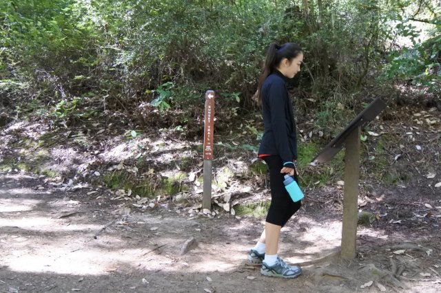
We started our hike making our way to Sunset Trail via Dool Trail from Park Headquarters.

 We walked up the gently sloping uphill section full of energy and just excited to finally start this long anticipated hike.
 At the top of this climb we crossed Middle Ridge Road and saw a map and trail post to let us know where the Sunset Trail continued. This next downhill section was one of my favorite sections (pretty much any downhill section was my favorite).
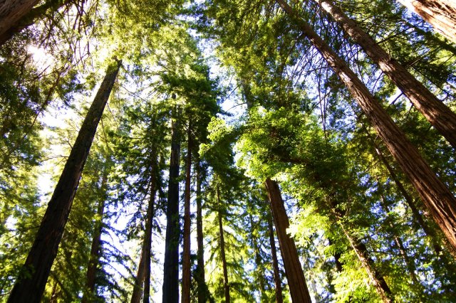
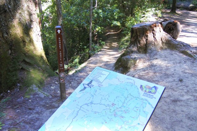 Majestic redwoods, dappled lighting, and very unique lush scenery is how I would describe this section. With every new type of scenery we encountered, we had fun pointing out what movie scene it reminded us of (the “otherworldly” description was perfect).


At the end of an uphill section we noticed that there seemed to be a clearing, the blue sky was definitely more visible. We were excited to see what we would find…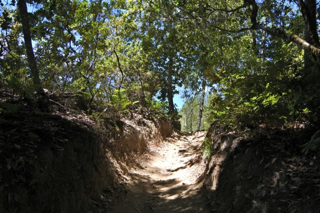 But first someone whose name I won’t mention (but we all know who that
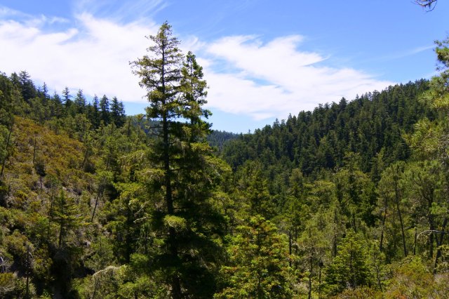
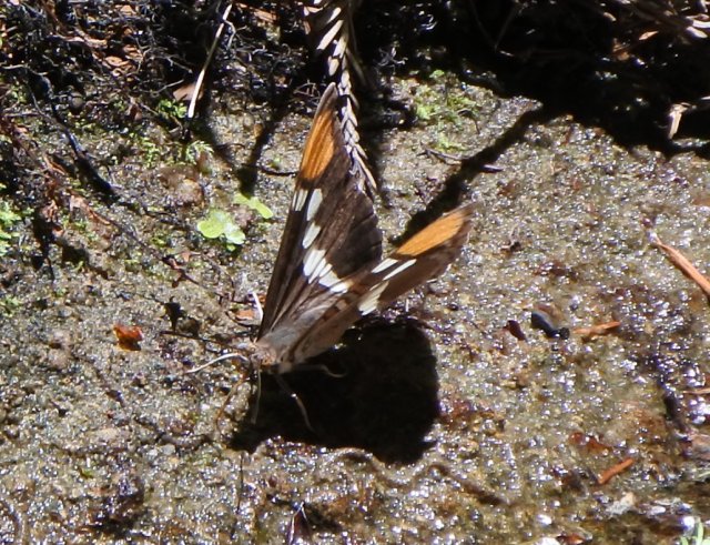
 girl person is) had to stop and take a picture of this lizard (impressive camouflage though).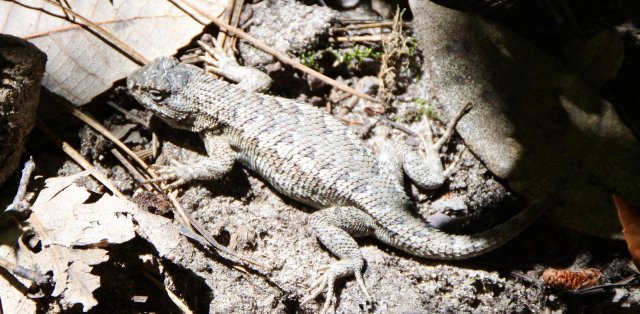 The section at the top of the ridge was very interesting, the trees opened up to an area of chaparral and the trail surface changed to smooth white rock. The difference in temperature when there was no shade was very noticeable. We snapped some pics and kept moving in search of some tree cover.


 We finally reached the Berry Creek Falls trailhead after about 5.5 miles. Up until this section on Sunset Trail, we only saw a handful of people making this a very serene hike so far. Immediately on the Berry Creek Falls Trail we encountered many more people, including a number of people with big back packs heading to Sunset Campground.

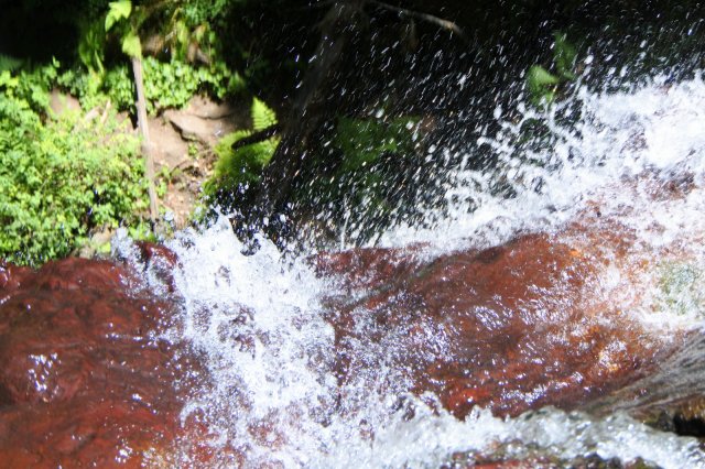
The distance to the first waterfall was short and we heard the waterfall first before we saw the top of the Golden Falls Cascade. I thought the Golden Falls Cascade was an appropriate name since the waterfall had a golden hue and it was also made up of two waterfalls close together making it a cascade. The trail followed the waterfall downward to the bottom.
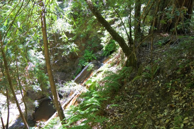


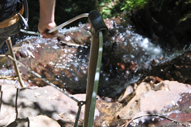
Continuing on we came upon the top of Silver Falls. This waterfall was thinner and taller than the Golden Falls Cascades (at least taller than one of them) and I loved that the trail led us right next to where the water flows off the ledge at the top. The trail turns into some steep steps that starts descending right next to the falls. Thankfully the stairs had rope guides that we held on to to help us make our way down. This section gets a little tight, but I liked that everyone was very considerate of each other as we all made our way up and down the narrow stairs.


It was actually a bit tricky to find a spot to sit for lunch since there weren’t many areas that allowed you to venture off the trail. But right before we were about to pass out from hunger we were able to find a spot next to a creek and off the trail a bit (right before a bridge). It was a beautiful spot, but apparently I must have been too hungry to care about taking a decent picture.

After refueling ourselves with lunch, we powered on to Berry Creek Falls. I can see why people say this is the most impressive out of the three. We kept an eye on the waterfall as we made our way down the trail to the viewing platform. The water coming down the falls felt and sounded powerful.

The final section was taking the Skyline to the Sea Trail back to headquarters. We sat on the bench to view Berry Creek Falls one last time and to psych ourselves up for the return trip. I think some talk about getting ice cream at the store got us moving again.


Overall, our camping trip to Big Basin State Park was a fun Father’s Day weekend getaway. The Berry Creek Falls hike was the highlight of the trip and I would definitely recommend it to anyone looking for a a challenging, yet rewarding hike through gorgeous ancient redwoods and meandering creeks to three impressive waterfalls. My pictures only touch upon what we saw during our 6 hour hike, so you’ll just have to come see for yourself how beautiful and varied the scenery is and experience the grandeur of the waterfalls in person :).
If you’re interested, check out our experience with the campground that we stayed in (Camping in California’s Oldest State Park).

A long walk but pictures and description seems like it was worth it.. Glorious waterfalls with parkservice care in evidence. I enjoy the way the blog takes us along the days journey. Know the “father” had this on his want to do list. Can see youth has the power now to do it all. I could not do the 11 miles so will have to look for a shorter waterfall hike to consider. Maybe the first one. The trees seem to invite the hiker to explore the beauty of its world. Ending with ice cream——oh yes.
LikeLiked by 1 person
An 11 mile hike might not be for everyone, but there are many other trails for all levels. I’m sure there is something just right for you. There is the easy 0.7 mile Redwood Trail loop where you can see some of the oldest and tallest redwood trees or the 1.9 mile Redwood Creek Canyon Trail loop if you want something longer. The Sempervirens Falls is one you could drive to or get to by a 4 mile hike from headquarters. I’m sure you’ll be able to find something to do just for you :). Whatever you decide don’t forget the ice cream at the end, I highly recommend the soft serve ice cream with a fresh raspberry swirl or the root beer float. Have fun out there!
LikeLike