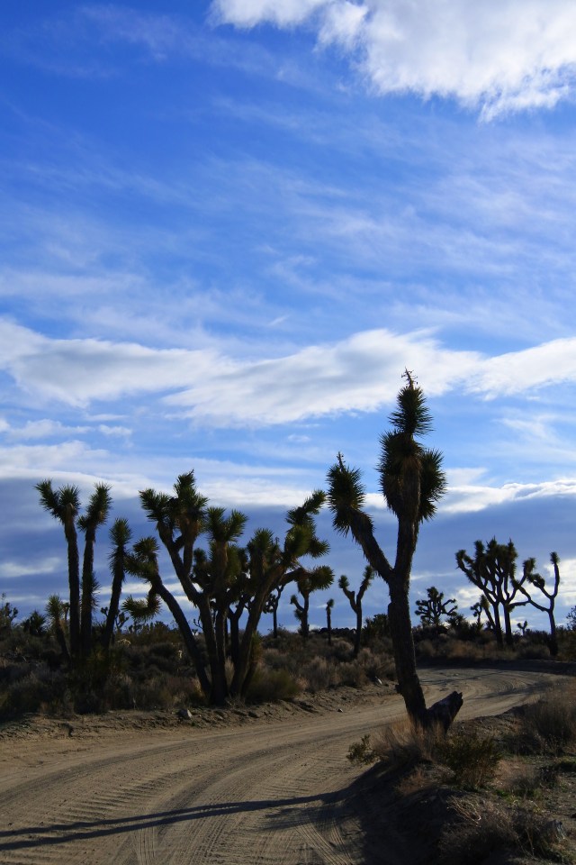
While visiting Joshua Tree during the busy holiday season, we came across 2 amazing and underrated hikes that allowed us to really experience Joshua Tree away from the crowds. The campgrounds were completely full and the park was brimming with many people like us who wanted to celebrate Christmas at Joshua Tree. Especially at the points of interests, the park was so crowded that the parking lots were overflowing and people were looking for creative ways to park on the road even a quarter of a mile up and down. We steadied ourselves for this chaos as we made our way to our hiking destination. We were heading to Desert Queen Mine Road to do the Desert Queen Mine Hike. As we made our right turn onto the dirt road, we noticed that we were the only vehicle of the long line of cars that turned off, a very good sign!

Desert Queen Mine Hike: (1.6 mile out and back to the mine, but you can make it a longer hike by going past the mine)
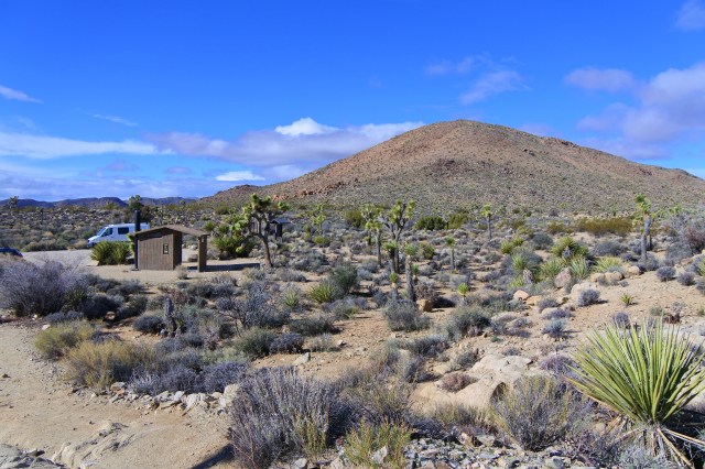
To get to the trailhead you have to drive about a mile and a half on a sometimes very bumpy dirt road (at least it seemed so in our van). Just this extra effort alone may have deterred people from this hike because the small parking lot only had about 4 cars parked in it when we arrived. From this parking lot, you can head off on three trails: Pine City Trail, Lucky Boy Vista Loop Trail, or Desert Queen Mine Trail. We wanted to see what was left of one of the most successful mining operations in the San Bernardino area, so we followed the Desert Queen Mine trailhead. FYI, there are vault toilets at the parking lot.
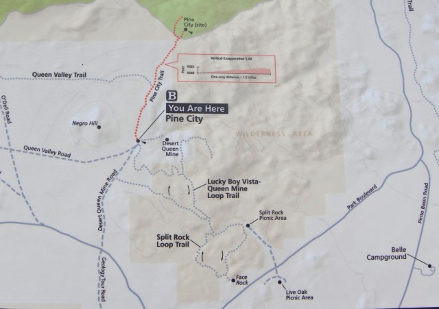
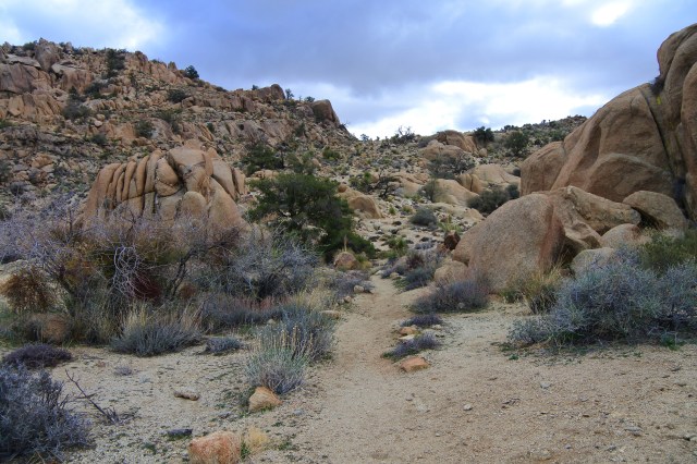
The trail started out with a gentle uphill slope. If you continue straight, you’ll reach a vista point where you can see the mines across the canyon.

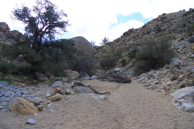
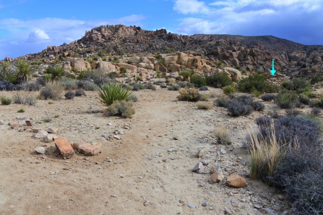
At the vista point, we stared across the canyon and picked out the areas that looked like remnants of a mining operation. When it was time to continue on, we couldn’t find where to go next. There was no trailhead or sign telling us where to go and we didn’t have a detailed map of the hike. We had no idea to turn around and make our way back to a branch off point (which we didn’t see) to continue the hike. Instead we followed what we thought was a trail down to the bottom of the canyon. There definitely is a trail, but at some points you do wonder if this really is a trail because it gets tricky with a lot of loose rocks. So, it’s up to you to decide what the best way is for you. You can hike down the canyon the way we did, or you can retrace your steps on the main trail and find the branch point for a more defined trail (see photo towards the end of the post). The branch point is hard to see but keep your eyes out for a rock foundation of a house and take the “trail” down past it (this is the way we returned).

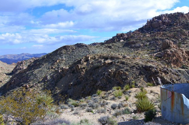

Once you cross the canyon floor, Gold Dust Gulch, you take a trail up the hill where you will start to see mine openings and old machinery. All of the openings have been closed with grates or heavy-duty netting, but you can look through the grates into the dark abyss of the shafts. Evidence of the mining operation is everywhere.


We took our time exploring the many mine shafts in the area, be sure to look on all sides of the hill, there are many. The shafts in the area produced almost 4,000 ounces of gold throughout nearly 75 years of operation. During this time, the mining operation changed hands many times. Frank James established the mine in the early 1890s, but the mine was “taken over” by Jim McHaney an outlaw gang leader and castle rustler. McHaney ultimately lost the mine to the bank, and the mine was finally passed to William Keys who operated the mine until 1961. Now Joshua National Park is protecting the mine and it was a great experience to be able to climb around in the area and see first hand what it must have been like.


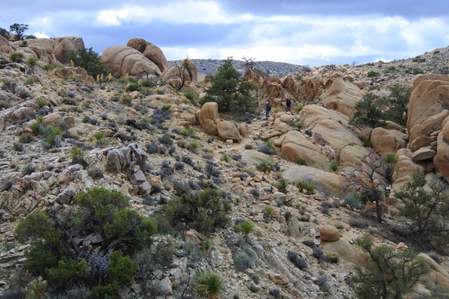


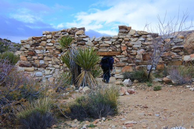
We didn’t encounter anyone on our way to the mining operation and beyond, but we did see a few groups heading to the Desert Queen Mine on our way back. So, if you want complete solitude, get a head start in the morning. On our way back we came across the stone foundations of a building, which seemed to have multiple rooms
We really enjoyed this hike, partly because of the interesting scenery, rich with mining history, and partly because we had the place to ourselves. It’s really only a 1.6 mile out and back hike to the Desert Queen Mine, but you can add more mileage by exploring the area more thoroughly and continuing the trail to the hill with amazing views. A great way to spend the morning!

Love the colors of the desert.
LikeLiked by 1 person
Me too!
LikeLike
This looks like a definite stop on the next Joshua Tree outing.
LikeLiked by 1 person
That’s awesome!
LikeLiked by 1 person
I’m going to pin this post so I can refer back to it when we get back out there. Great tips for finding the trail and also finding a less crowded hike.
LikeLiked by 1 person
Thanks!!
LikeLike
That’s a lot for writing these explorations up for Joshua Tree. I’m going to reread them whenever we get a chance to go again. Hopefully some day WITH you expert campers!
LikeLiked by 1 person
Thanks Erika! Can’t wait to camp with you guys someday!
LikeLike